Travel Guide› Chongqing› Jinfo Mountain (Jinfoshan)
Chongqing · Park

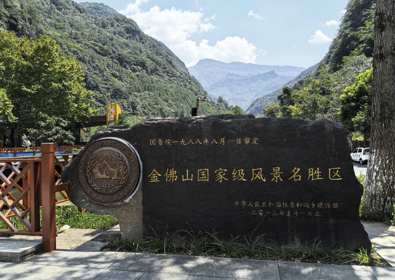
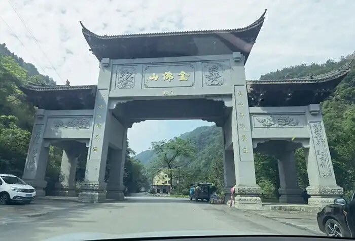
Jinfo Mountain (Jinfoshan) 金佛山

Jinfo Mountain (Jinfoshan)
Address
Jinfo Mountain Scenic Area, Nanchuan District, Chongqing (entrances available on south slope/west slope/north slope)

I. Overview

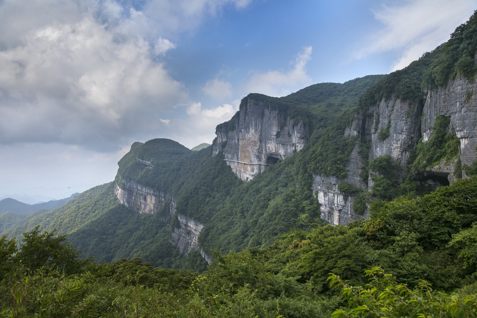
Jinfo Mountain (Jinfo Shan) sits in Nanchuan District, Chongqing, at the northern end of the Dalou Mountain range. Its highest peak, Fengchui Ridge, rises to 2,238 meters — the tallest point in the entire Dalou range. The mountain was once known as "Jiudi Mountain" in ancient times. Its current name, which means "Golden Buddha Mountain," comes from a spectacular light phenomenon: on clear summer and autumn evenings, the setting sun drenches the cliffs in a blaze of gold, making the mountain look like a colossal gilded Buddha radiating beams of crimson light in every direction.

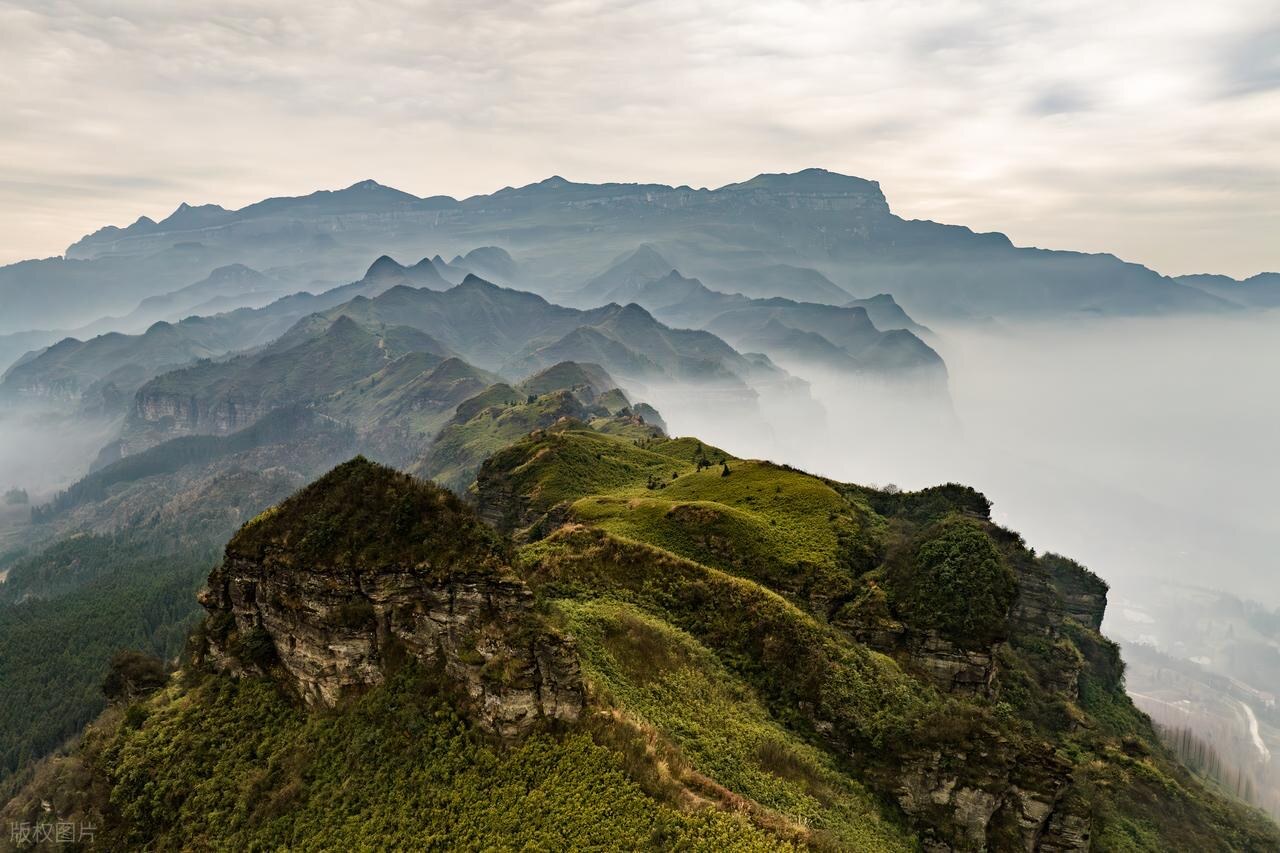
A UNESCO World Natural Heritage Site and a national 5A-class scenic area, Jinfo Mountain is celebrated for its unique karst mesa landforms, extraordinary biodiversity, and a long history of saltpeter smelting. The scenic area covers 1,300 square kilometers, with forest cover exceeding 95% — a true natural oxygen sanctuary and summer escape. From the air, the mountain resembles a dragon's head held high at the northern tip of the range, combining grandeur, drama, ruggedness, elegance, and seclusion into one breathtaking landscape.

II. Attractions by Route

West Slope Classic Route

  1. Bitan Yougu (Emerald Pool Gorge)
  2. Jinfo Heavenly Ladder
  3. Qianniu Ping
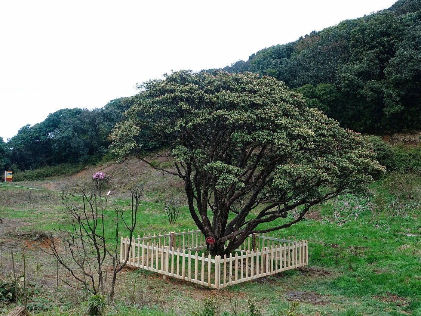
  4. Rhododendron King Tree
  5. Yaochi Ba
  6. Gufo Cave
  7. Ecological Stone Forest
  8. Lingkong Plank Walk
  9. Golden Tortoise Facing the Sun
  10. Jiulian Baoding

North Slope Classic Route

  1. Gufo Cave
  2. Yaochi Ba
  3. Cliffside Plank Walk
  4. Golden Tortoise Facing the Sun
  5. Qianniu Ping
  6. Jinfo Temple
  7. Ecological Stone Forest
  8. Skyline Trail
  9. Jiulian Baoding

South Slope Classic Route

  1. Route 178 Loop
  2. Jinshan Lake
  3. Toudu Town
  4. Guanyin Rock Rest Stop
  5. Longyan Fortress
  6. Qianniu Ping
  7. Jinfo Temple
  8. Ecological Stone Forest
  9. Lingkong Plank Walk
  10. Golden Tortoise Facing the Sun
  11. Jiulian Baoding

III. Attraction Descriptions (up to 200 words each)

Bitan Yougu (Emerald Pool Gorge)

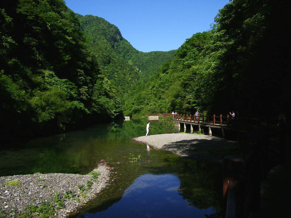
Bitan Yougu is one of Jinfo Mountain's most popular spots, located at the base of the mountain about 2 kilometers from the main entrance. The gorge stretches roughly 3.5 kilometers, carved by sheer cliffs, with ancient trees, old vines, mossy boulders, and cascading waterfalls. Annual rainfall reaches 1,400 millimeters; the area sits in fog roughly 260 days a year, and summer temperatures rarely climb above 20°C — perfect for escaping the heat. Crystal-clear streams wind along the valley floor beneath layered canopies of flowering trees and emerald hills. Long a favorite among hikers, the gorge now offers glamping tents for visitors who want to linger. With its serene atmosphere and rich natural scenery, Bitan Yougu makes an ideal starting point for a Jinfo Mountain journey.

Jinfo Heavenly Ladder

The Jinfo Heavenly Ladder is the mountain's classic hiking trail — about 11 kilometers long, with an elevation gain of nearly 1,900 meters. The path traces an ancient route dating to the Republican era, used for centuries by herb collectors and pilgrims, and remains one of the finest routes for a mindful mountain walk. The first half is relatively gentle; the second half grows steep and demanding, with stone steps pitching up to a 70-degree angle. Along the way, karst formations rise through dense forest. Reach the top and the whole of Jinfo Mountain unfolds below you.

Qianniu Ping

Qianniu Ping is a sweeping alpine meadow on Jinfo Mountain's west slope, sitting above 2,000 meters. The plateau is broad and open, carpeted in green grass and wild flowers. In summer it's a beloved cool retreat; in winter it transforms into a ski destination. Three ski areas — North Slope, West Slope, and Yaochi Ba — cover roughly 150,000 square meters in total, with zones for skiing and snow play. Qianniu Ping is also home to the World Wild Ancient Rhododendron Park: every April and May, more than 600,000 native tree rhododendrons burst into bloom, six species found nowhere else on earth, blanketing the hillsides in waves of color. The plateau is equally prized for watching sea-of-clouds sunrises and other natural sky displays.

Rhododendron King Tree

The Rhododendron King Tree is one of Jinfo Mountain's landmark sights, standing within the Qianniu Ping area. This ancient rhododendron is 13.8 meters tall, with a trunk circumference of 3.77 meters and a base girth of 7 meters — the oldest, most massive, and broadest-canopied coarse-veined rhododendron in the world. In 1997, Guinness World Records certified it as the "Millennium Rhododendron King." Each year from late April to mid-May, the tree erupts in more than ten thousand blossoms — crimson clusters draped across the ridgeline like vivid brocade. The tree is not only a botanical treasure but a living symbol of Jinfo Mountain's biodiversity. Standing beneath it, you can feel the weight of a thousand years.

Yaochi Ba

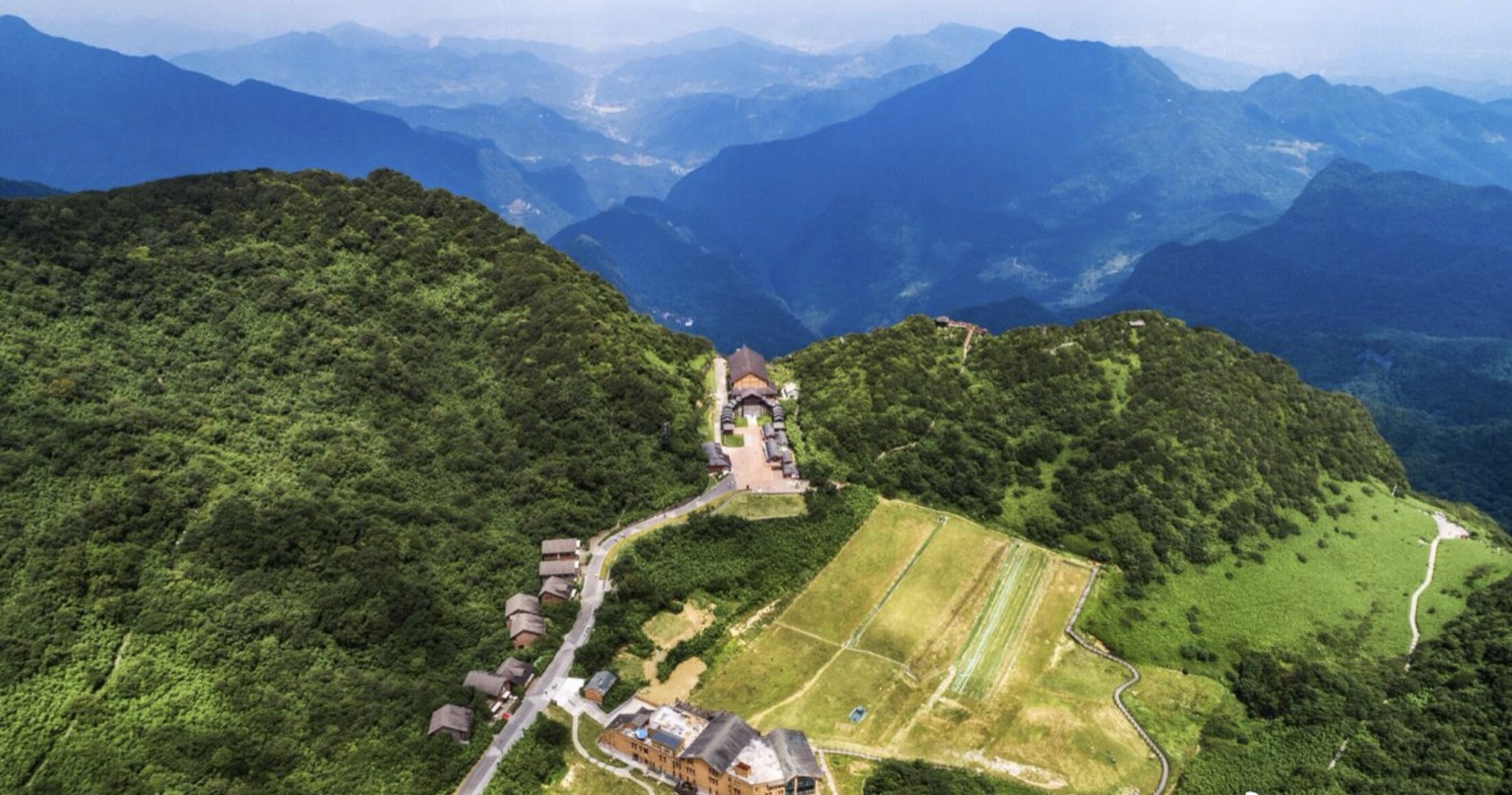
Yaochi Ba sits at roughly 2,100 meters elevation in the middle section of the scenic area, where alpine meadows meet small lakes in a landscape that feels genuinely unhurried. The air is cool and exceptionally clean, with very high negative-ion levels. Lush vegetation, clear water, and wide-open grassland surround the area; on a blue-sky day, hills dotted with wildflowers reflect in the lake surface beside scattered tents. Yaochi Ba is also one of the best positions for panoramic views of Jinfo Mountain and a window into the mountain's wild plant and animal life. In winter, the area doubles as a family ski zone — the Yaochi Ba ski field is themed around snow fun for children, with snowman-building and snowball fights at its heart.

Gufo Cave

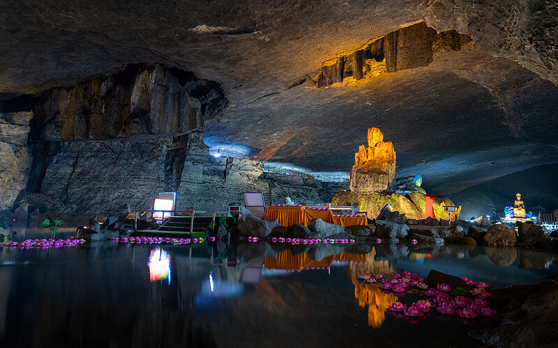
Gufo Cave sits at 2,100 meters and is considered one of the world's highest-altitude and geologically oldest rainwater-fed parallel cave systems. The total passage length is 3,777 meters; about 1,200 meters are open to visitors, with a chamber area of 46,800 square meters. It is known as the "Number One Buddhist Cave Under Heaven." Inside stand 1,250 Luohan statues alongside naturally formed stalactite figures in a staggering variety of poses. The cave also preserves a complete saltpeter-smelting site from more than 700 years ago — pits, pools, and kiln scorch marks that bear witness to China's early gunpowder industry. The interior holds steady at around 18°C year-round. Qing dynasty pilgrims left inscriptions on the walls, including phrases such as "Where the heart is at peace, that is home." Just outside the cave entrance, the ridgeline takes the shape of a tortoise craning its neck toward the east, a natural counterpoint to the wonders within.

Ecological Stone Forest

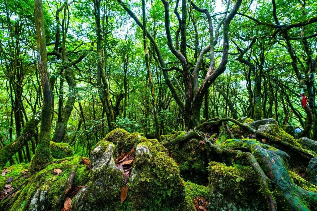
The Ecological Stone Forest is a textbook example of karst stone-forest landscape within Jinfo Mountain's scenic area, valued highly by geologists. What sets it apart from stone forests elsewhere is the symbiotic relationship between rock spires and ancient trees: here, stone wraps around trees and trees embrace stone. Among the rare plants rooted in the limestone is the Chinese yew (Taxus chinensis). Dense forest, tangled vines, and profound quiet make this one of the finest places on the mountain for immersive nature exploration. The rock spires themselves take on wildly different shapes — some thrust skyward like blades, others crouch like ancient beasts — composing a scene that looks as though it arranged itself.

Lingkong Plank Walk

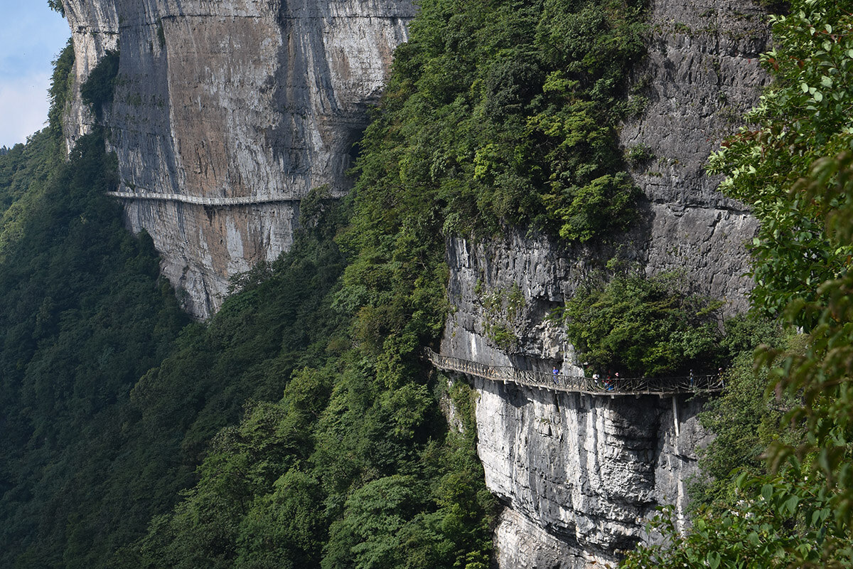
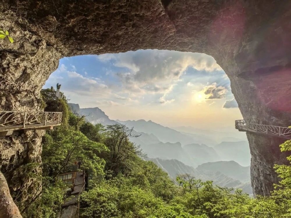
The Lingkong Plank Walk is one of Jinfo Mountain's most distinctive experiences: approximately 3.5 kilometers long, suspended up to nearly 100 meters above the ground, it links several of the mountain's core attractions. The walk is built in two sections — the first 1.5 kilometers clings to a sheer vertical cliff face (the "Absolute Cliff Corridor"), while the remaining 2 kilometers spiral up along the rock wall (the "Sky Walk"). Along the route you pass karst caves including Yanzi Cave and Lingguan Cave, as well as some of the mountain's most dramatic cliff scenery. Standing on the walkway with a bottomless gorge below and wave upon wave of peaks in the distance, it feels — especially when clouds roll in — like walking through another world. The design prioritizes both safety and maximum views.

Golden Tortoise Facing the Sun

Golden Tortoise Facing the Sun is one of Jinfo Mountain's signature sights, located where the west slope cliffs meet the gentler upper terrain. The mountain here unmistakably resembles a massive tortoise stretching its neck eastward, with plump shell and narrow head, the cliff walls forming the shell's edge — an entirely natural masterpiece. At dawn, morning light pours over the tortoise-shaped rock in glittering gold; at dusk, the setting sun turns the whole formation into a blazing gilded vision. The Golden Tortoise viewing platform is the go-to spot for photographing Jinfo Mountain's sea of clouds, sunrises, and sunset skies. Flocks of cliff swallows nest in the crags nearby; at dawn and dusk, thousands of birds take flight together, bringing the silent stone tortoise to life.

Jiulian Baoding (Nine-Lotus Summit)

Jiulian Baoding sits at the mountain's highest peak, Fenghuang Ridge, at 2,238 meters — the ultimate viewpoint and the crown of Jinfo Mountain. The panorama from here takes in the full sweep of Jinfo Mountain and the transitional zone between the Yunnan-Guizhou Plateau and the Sichuan Basin. On clear days, nine peaks rise above the cloud sea like lotus petals opening — the "nine-lotus" image that gives this summit its name. This is also the best place to witness Jinfo Mountain's "Buddha light" phenomenon: when sunlight strikes at the right angle through mist, a seven-color halo forms on the mountain, glowing like a sacred aureole. As a core zone of the World Natural Heritage Site, Jiulian Baoding showcases both the mountain's distinctive geology and its most spectacular scenery.

Reclining Buddha of Heaven and Earth

The Reclining Buddha of Heaven and Earth is one of Jinfo Mountain's most celebrated natural sights — a ridgeline on the mountain's north face that stretches for more than ten li (several kilometers) in the unmistakable outline of a giant Buddha lying at rest. In summer and autumn, when the evening sun floods the peaks with amber and crimson light, the entire mountain seems to glow like a gilded Buddha radiating countless beams of light — a sight of rare beauty. The ancient verse "How majestic is Jinfo, floating between clouds and colored sky" perfectly captures it. The Reclining Buddha is the origin of the mountain's name and a defining icon of South China's karst mesa landscape, where nature and cultural imagination merge seamlessly.

Gufo Cave Celestial Realm

Gufo Cave Celestial Realm is Jinfo Mountain's premier cave spectacle, located at 2,100 meters elevation — one of the world's highest-altitude and oldest rainwater-fed parallel cave systems. The chambers are vast, and stalactites take on every imaginable form, illuminated lighting creating an otherworldly effect. The cave preserves intact saltpeter-smelting remains — mounds of saltpeter-bearing earth and smelting kilns — as evidence of a manufacturing tradition more than 700 years old. Inside, 1,250 Luohan statues line the walls alongside naturally formed stone Buddha figures, producing a spectacle of "a thousand Buddhas, a thousand faces." The cave maintains a constant temperature of 18°C year-round and is well ventilated — an excellent cool retreat. The ridge immediately outside the entrance takes the natural shape of a tortoise gazing east, a fitting natural frame for what lies within.

Southern Snow Plateau

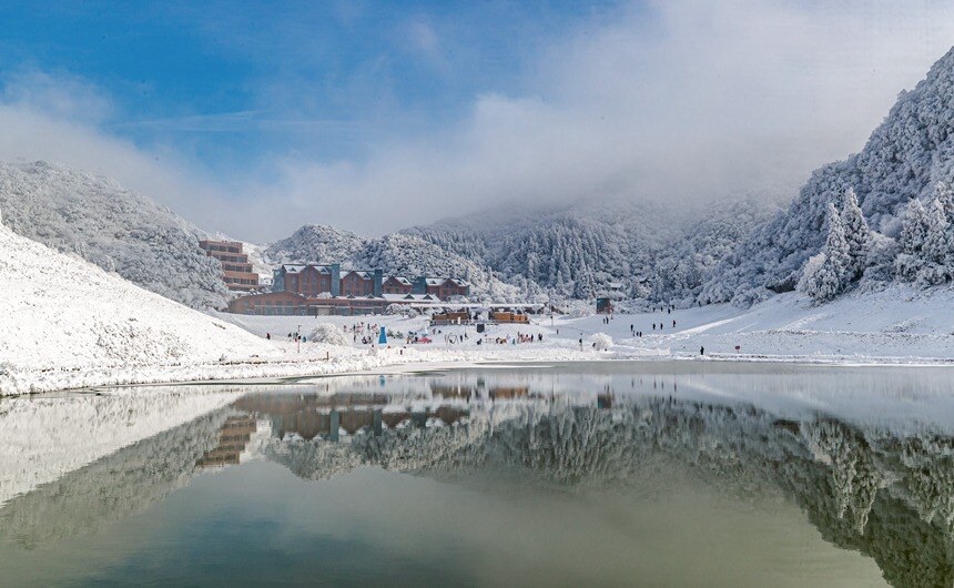
The Southern Snow Plateau is Jinfo Mountain's defining winter attraction. From mid-November through March the following year, temperatures can drop to minus 10°C, and snow covers the mountain for three to four months. Heavy snowfall accumulates into stunning formations of icicles, ice columns, frozen waterfalls, and ice-draped trees — works of nature as intricate as hand-carved white jade. Three ski areas totaling more than 100,000 square meters operate across the mountain in winter; Jinfo Mountain is also an authorized junior ski training base of the International Ski Federation. Visitors can experience rime ice, ice curtains, and frozen waterfalls — ice-and-snow wonders rarely found at this latitude. When sunlight breaks through the clouds onto the snow-covered peaks, the entire mountain turns silver-white and radiant.

Kingdom of Rhododendrons

The Kingdom of Rhododendrons represents Jinfo Mountain's most spectacular living landscape: the most complete and extensive high-altitude ancient rhododendron community in the world at this latitude. The mountain supports 44 species and more than 600,000 native tree rhododendrons, of which six are endemic to Jinfo Mountain alone — known as the "World's Six Great Rhododendron Rarities." From March through May, rhododendrons bloom in succession from the foot of the mountain to the summit, spreading across ten thousand acres in waves of crimson, white, and pink. Individual trees here are large and robust — canopies spanning more than ten meters across, with a single tree producing tens of thousands of blossoms at once, like cascades of living brocade. This rhododendron kingdom is both a spectacular visual display and a symbol of the mountain's extraordinary biodiversity.

Jinfo Temple

Jinfo Temple was first built during the Tang dynasty and reached its height during the Ming dynasty; it is an important Buddhist heritage site within the scenic area. The temple is set into the hillside, quiet and sheltered, surrounded by old-growth forest and unusual rock formations. Preserved inside is a poem by Qing dynasty Chan master Minshu Ruxiang, written after visiting the mountain: "The ancient Buddha once left traces here, and the auspicious glow of Nanchuan opened at dawn. A single ridge of extraordinary peaks pierces the sky; a thousand fathoms of brocade river surge with piled green." The poem vividly captures both the mountain's grandeur and its Buddhist spirit. Jinfo Temple's ancient, understated architecture exemplifies the aesthetic of traditional Chinese Buddhist building. As the chief vessel of Buddhist culture on Jinfo Mountain, the temple stands as a witness to more than a thousand years of religious life here.

Jinping Diecui (Brocade Screen Layered Green)

Jinping Diecui lies on Jinfo Mountain's south side, where six peaks arranged in staggered sequence, separated by ravines, form a landscape that unfolds like a giant folding screen — hence the name "Brocade Screen Layered Green." Vegetation here is exceptionally dense; the scenery shifts with every season: spring brings cascading blossoms, summer saturates everything in green, autumn sets the forest ablaze with color, and winter leaves the peaks in snow. The terrain is complex, cut through by gullies and winding streams, producing a distinctive mountain-and-water composition. From the Jinping Diecui viewing platform, the full sweep of Jinfo Mountain's southern flank stretches out below, with the transition zone between the Yunnan-Guizhou Plateau and the Sichuan Basin in the distance. The area is as much a geological exhibit as it is a scenic one, illustrating the range and beauty of karst landforms.

Meiling Bridge

Meiling Bridge is a historical site within the scenic area, located near Tianxing Town. The bridge was built during the War of Resistance against Japan, constructed by local gentry and merchants to ease travel while Chongqing served as the wartime capital. Historical records indicate that Chiang Kai-shek and his wife Song Meiling spent four days on Jinfo Mountain and were deeply taken with the scenery. Song Meiling was apparently especially fond of the Sanquan hot springs; a building resembling the bridge appeared in her later paintings, believed to depict the Jinfo Mountain landscape. The bridge is elegant in form, with a graceful arch and finely carved decorative details in the traditional Chinese style. As a historical witness to the wartime era, Meiling Bridge is one of the best places on Jinfo Mountain to connect with its human history.

Sanquan Hot Springs

Sanquan Hot Springs is one of Jinfo Mountain's eight celebrated wonders, located on the mountain's north slope along the Longyan River. Three springs emerge side by side from the same geological cross-section: a scalding spring to the east (reaching 60°C), a cool spring to the west (just 9°C), and a warm spring between them. This extraordinary phenomenon results from differences in the hydrogeological conditions of underlying rock layers — entirely natural. During the War of Resistance, Chiang Kai-shek and Song Meiling rested here and praised the springs and the landscape; Chiang reportedly remarked that "Jinfo Mountain is a match for Lushan." The setting is beautiful: forested hills, flowing streams, and the soothing sound of water everywhere — ideal for unwinding. The spring water is rich in metasilicic acid, strontium, and other trace minerals with recognized therapeutic benefits.

Jinfo Peak Summit

The Jinfo Peak summit is one of the highest points in the scenic area, rising to approximately 2,238 meters — the ideal vantage point for a 360-degree view of Jinfo Mountain and the broader transition zone between the Yunnan-Guizhou Plateau and the Sichuan Basin. The summit is also a traditional wishing spot, and special events are held here during major festivals. Looking down from the peak, the Yaochi Ba grassland and the surrounding karst formations spread out in all directions. The ridgeline here is steep and layered, creating an atmosphere of both mystery and solemnity. According to legend, this is the site where an ancient Buddha first appeared and where Randeng Ancient Buddha's dharma practice originated.

Route 178 Loop

The Route 178 Loop is a self-drive touring circuit approximately 178 kilometers long, centered on Jinfo Mountain and threading through multiple townships and scenic points. The route combines natural scenery and cultural heritage: along the way you can take in alpine meadows, dark-rock stone forests, valley waterfalls, ancient ginkgo groves, Qing dynasty cave fortress ruins, and the Guanyin Rock ancient post station, among other highlights. The loop is designed with different traveler needs in mind — gentle stretches suitable for families, and rugged mountain sections for experienced hikers. Camping grounds, rural guesthouses, and outdoor activities including paragliding and via ferrata are scattered along the route, giving visitors a wide range of ways to experience the landscape.

Jinshan Lake

Jinshan Lake sits on Jinfo Mountain's south slope, one of the key attractions on the Route 178 Loop. The lake is broad, its water clear, wrapped on all sides by mountains. Wooden cabins and walkways line the shore, providing relaxed spaces for strolling and taking in the view. The lake's formation is closely tied to Jinfo Mountain's geological structure — a hydrological expression of the karst landscape. The surrounding hills and sky reflect in the still water, producing a classic mountain-and-lake composition. Vegetation around the lake is thick, with very high negative-ion levels in the air, making it a natural retreat on a warm day. Viewing platforms and rest areas are available along the shoreline.

Toudu Town

Toudu Town is the main township near Jinfo Mountain on the Route 178 Loop. Traditional Bayu-style architecture survives along clean, well-kept streets. The town offers an authentic window into local folk culture, with restaurants serving Jinfo Mountain specialties such as arrow bamboo shoot with preserved pork and medicinal lamb soup. Surrounded by mountains and scenery, it makes a natural base for self-drive visitors. A via ferrata climbing route is also available nearby for those who want a physical challenge. Toudu Town is more than a rest stop — it is where the mountain's rural character and local life come together.

Guanyin Rock Rest Stop

The Guanyin Rock Rest Stop is a key node on the Route 178 Loop within the scenic area. Built against the hillside, it is a quiet place with ancient trees, streams, and natural surroundings. This was once a staging post on the ancient Tea-Horse Road, a silent witness to centuries of trade and travel across the Jinfo Mountain region. A rest area and viewing platform are available for visitors to pause and take in the mountain scenery. The ridgeline around the rest stop is steep and layered with cloud, the view shifting constantly. Looking out from here, the main peak of Jinfo Mountain stands in the distance.

Longyan Fortress

Longyan Fortress is a historical site within the scenic area, built during the Southern Song dynasty. Together with Diaoyu Fortress in Hechuan, it was one of the most important strongholds in the resistance against Mongol forces. The fortress was built into the natural terrain, surrounded on all sides by sheer cliffs, commanding the mountain passes between Sichuan and Guizhou — a position of total strategic dominance. The gate still bears the carved inscription "Panlong Stronghold," and remnants of walls and barracks survive inside. The landscape around the fortress is steep and dramatic, and the site is preserved as a patriotic education base, bearing witness to a significant chapter in China's medieval military history.

Jinfo Peak Prayer Trail

The Jinfo Peak Prayer Trail connects Jinfo Temple to Jiulian Baoding, running approximately 2 kilometers through dense, quiet forest. Buddhist cultural display boards along the route introduce the mountain's religious history and legends. The trail ends at Jiulian Baoding, one of the mountain's highest points and a sacred site for Buddhist pilgrims. The walk is gentle and accessible to visitors of most fitness levels; multiple rest points are provided along the way. More than a hiking path, the Prayer Trail serves as a thread connecting the mountain's natural landscape to its spiritual heritage.

Skyline Trail

The Skyline Trail is another distinctive walking route on Jinfo Mountain, running along terrain above 2,000 meters in elevation. About 3 kilometers long, the trail is built along a steep ridgeline that winds through the mountain like a ribbon. The views are wide open, with Jinfo Mountain's full panorama laid out below; when clouds roll in, the sensation of walking above them is genuinely extraordinary. Multiple viewing platforms are placed along the route. The trail is flanked by dense forest and deep quiet, a natural counterpart to the Lingkong Plank Walk — together they form Jinfo Mountain's layered vertical landscape system. Safety and scenic quality are both prioritized in the trail's design.

West Slope Cable Car

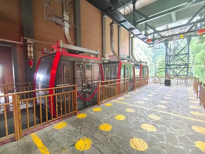
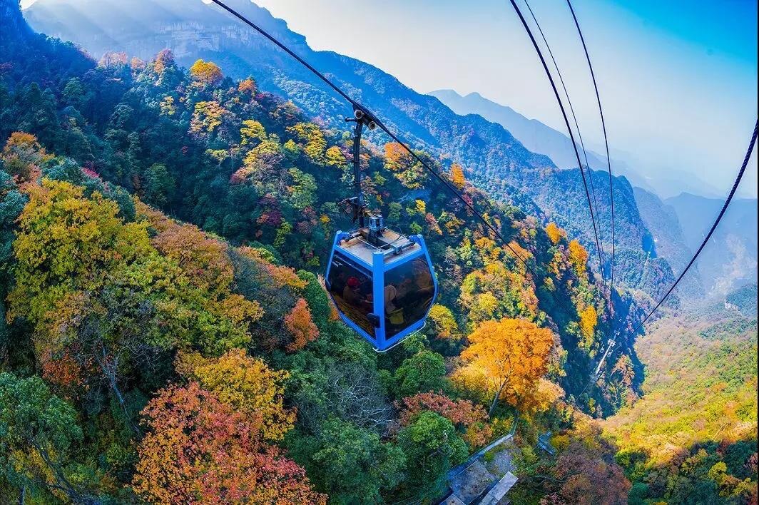
The West Slope Cable Car is a key piece of transport infrastructure within the scenic area. The line is approximately 2,700 meters long, rises 900 meters in vertical elevation, and was designed and manufactured by Poma of France. It runs at 6 meters per second. The cable car travels from the West Slope lower station directly to the main summit area, passing through remarkable mountain scenery. The gondola provides 360-degree viewing, letting riders look down on ridges and sea-of-clouds from directly above. It is the preferred way to reach the summit quickly, particularly for visitors who prefer to conserve energy. Operating hours: 8:00–17:30 (ticket sales close at 17:00, last entry at 17:30).

North Slope Cable Car

The North Slope Cable Car is another important transport line within the scenic area, running from the North Slope lower station to the summit. Specifications are identical to the West Slope line: approximately 2,700 meters long, 900 meters of vertical rise, Poma-built, running at 6 meters per second. Riders on this line can take in the North Slope scenery as they ascend — Yaochi Ba's alpine meadows, the cave formations of Gufo Cave, and more. The 360-degree gondola design provides full panoramic views. The North Slope line is a good alternative for visitors who want to avoid the busier West Slope crowds. Operating hours: 8:00–17:30 (ticket sales close at 17:00, last entry at 17:30).

South Slope Cable Car

The South Slope Cable Car is the third cable car line in the scenic area, running from the South Slope lower station to the summit. Specifications mirror the other two lines: approximately 2,700 meters long, 900 meters of vertical rise, Poma-built, running at 6 meters per second. Riders get views of Jinping Diecui and Longyan Waterfall on the south side of the mountain. The gondola design provides 360-degree views. The South Slope line is the preferred choice for self-drive visitors — from the south slope, drivers can reach the Qianniu Ping parking area and then continue on foot or by shuttle bus to explore the summit. Operating hours: 8:00–17:30 (ticket sales close at 17:00, last entry at 17:30).

Tianxing Hot Spring Resort

Tianxing Hot Spring Resort is located in Tianxing Town within the scenic area and serves as Jinfo Mountain's main leisure and resort hub. The resort features multiple specialty pools, including Nanchuan Arrow Bamboo Dampness-Relief Soak and Mugwort Cold-Dispelling Soak. The spring water is rich in metasilicic acid, strontium, and other beneficial trace minerals. The setting is beautiful, ringed by mountains with the sound of running water throughout, making it a natural place to decompress after a day on the mountain. The resort also includes hotel accommodation, dining, and recreational facilities for a full holiday experience. For visitors who want to combine mountain sightseeing with a proper soak, Tianxing Hot Spring Resort is the obvious place to end the day.

Practical info Opening hours · Ticket · Getting there
Opening hours
  • Scenic Area: 08:00-17:30 (last entry at 16:30)
  • Cable Car: 08:30-17:00
  • Note: Jinfo Mountain covers a vast area; it is recommended to allow a full day for the visit; if you want to see the sunrise and sea of clouds, you can choose to stay overnight on the mountain
Ticket
  • Admission: Peak season (March-October) 70 RMB/person; Off season (November-February next year) 50 RMB/person
  • Cable Car: Round-trip 80 RMB/person (recommended to purchase, saves significant physical effort)
  • Skiing/Snow Play: Charged separately in winter, about 120-180 RMB/person (including ski equipment rental)
  • Discounted Tickets: Students, seniors, military personnel, etc. can enjoy half-price or free admission with valid ID
  • Note: It is recommended to purchase combo tickets (admission + cable car) in advance through the official WeChat account or travel platforms for discounts and to avoid on-site queuing
Getting there
  • From Chongqing urban area:
    • Driving: Drive along the Chongqing-Xiangtan Expressway (G65) to the Jinfo Mountain exit, follow signs to the scenic area, about 1.5 hours' drive
    • Bus: Take a shuttle from Chongqing Sigongli Transport Hub to Nanchuan District, about 1.5 hours, fare about 35 RMB; after arriving in Nanchuan, transfer to bus or taxi to the scenic area (about 30 minutes)
    • High-speed Rail: Take the Chongqing-Xiamen High-speed Railway to Nanchuan North Station, about 30 minutes; after arrival, transfer to bus or taxi to the scenic area (about 40 minutes)
    • Scenic Area Direct Bus: There are tourist direct buses from Chongqing Jiefangbei, Hongya Cave, etc. directly to Jinfo Mountain, round-trip about 100-120 RMB/person
  • Within the scenic area: There are environmentally friendly shuttle buses in the scenic area; it is recommended to purchase environmentally friendly shuttle bus + cable car combo tickets for convenient sightseeing

Inside Jinfo Mountain (Jinfoshan)

15 stops, in walking order — read top to bottom, no clicking needed.

1 Main Gate (North Gate) of 15

Main Gate (North Gate)

大门

The Main Gate sits at the foot of Jinfo Mountain's north slope near Tianxing Town and serves as the first stop for most visitors. The entrance complex combines a large parking lot, visitor center, ticket windows and self-service kiosks where combined tickets for admission, cableway and shuttle can be purchased. An eco-shuttle bus ride of about 20 minutes reaches the cableway lower station, passing lower-zone sights such as Bitan Valley. The visitor center offers panoramic maps, rain-poncho rental and luggage storage, and doubles as the registration point for winter ski equipment. Outside the gate, Tianxing Town provides dining, lodging and specialty shops—a common base for two-day "valley-to-summit" itineraries.

On-site narration · read it where you stand

Welcome, everyone! Welcome to Jinfo Mountain in Nanchuan, Chongqing. Today I'll be taking you along the following route: West Gate — Bitan Yougu — cable car lower station — cable car upper station — Qianniu Ping Sky Street — Arrow Bamboo Forest Sea — Golden Tortoise Facing the Sun — Skyline Trail — Yanzi Cave — Lingguan Cave — Rhododendron Prince — Yaochi Ba — Gufo Cave — Jinfo Peak — Ecological Stone Forest — West Gate cable car lower station — West Gate. Together we'll discover what it means to visit a UNESCO World Natural Heritage Site, often called the "Oriental Alps." Jinfo Mountain was inscribed on the World Heritage List in 2014 as a key component of the South China Karst Phase II project.

Jinfo Mountain is also known as Jinshan, and in ancient times was called Jiudi Mountain. It lies within Nanchuan District, Chongqing, as part of the Dalou Mountain range. The scenic area comprises three mountains — Jinfo, Qingba, and Baizhi — and 108 peaks. The main summit, Fengchui Ridge, reaches 2,251 meters, making it the highest point in the Dalou range. Jinfo Mountain is world-renowned for its distinctive karst mesa landforms, extraordinary biodiversity, and the centuries-long tradition of saltpeter smelting that shaped its cultural history.

Bitan Valley (Green Pool Secluded Gorge)

碧潭幽谷

Located at 700–1,000 m elevation on Jinfo Mountain's north slope, Bitan Valley is the key lower-zone landscape along the route from the main gate to the cableway lower station. The roughly 3 km gorge winds up along a mountain stream between steep, densely forested cliffs that shelter rare species such as yew and dove tree. Over a dozen deep pools dot the valley—the largest, "Bitan" (Emerald Pool), is jade-green and translucent, traditionally said to be where ancient monks washed their alms bowls. Wooden boardwalks and stone paths pass waterfalls, cascades and moss-covered walls; summer temperatures run 5–8 °C cooler than the base, making this a classic hot-season hiking route. The full walk takes about 1.5–2 hours.

On-site narration · read it where you stand

We're now leaving the West Gate visitor center by sightseeing bus, heading to Bitan Yougu. The gorge lies on Jinfo Mountain's west slope and stretches approximately 3.5 kilometers. The gorge was carved by the mountain's sheer cliffs and drops away from the summit in a winding cascade downward. Ancient trees soar overhead, old vines drape across the path, moss covers every surface, and the landscape retains its original, untouched character. Bitan Yougu also contains karst cave formations — Lingxiao Cave and Xianzhong Gorge among them — as well as distinctive spots like Bitan Lake and the Cherry Blossom Terrace.

The best time to visit Bitan Yougu is spring or winter, when temperatures are ideal and the scenery is at its most dramatic. Negative-ion levels inside the gorge reach 100,000 per cubic centimeter — genuinely exceptional air quality that has earned it the nickname "natural oxygen sanctuary." As you walk through, look carefully at the vegetation on both sides for rare and protected species such as the silver fir and the Chinese yew. A troop of wild macaques also lives in Bitan Yougu — lively and entertaining to watch, but please do not feed or disturb them.

Cableway Lower Station (North Slope)

索道下站

The lower station of Jinfo Mountain's north-slope cableway sits at about 1,100 m above Bitan Valley and is the mountain's most critical transit hub. The cableway spans roughly 1,100 m with an elevation gain of about 600 m; each cabin holds dozens of passengers and the ride takes about five minutes, offering aerial views of gorges and primeval forest. The lower station has a waiting hall, ticket windows and a rest area; queues at peak times can reach 30–60 minutes, so off-peak travel is advised. An outside viewing platform frames the main summit ridge and serves as a key photo spot for winter snow and autumn foliage. Exiting the upper station places you at Qianniuping Sky Street—the gateway to the summit zone. The cableway may suspend operations in high wind or thunderstorms.

On-site narration · read it where you stand

We've arrived at the Bitan Yougu cable car lower station and are about to ride the gondola up the mountain. The Jinfo Mountain West Slope cable car is approximately 2 kilometers long and takes about 10 to 15 minutes one way, lifting us from the lower station at roughly 1,000 meters elevation to the upper station plaza at over 2,000 meters. This line is known as the "Jiaolv · Jinfo Mountain Cable Car" and is one of the longest gondola-lift lines in Southwest China.

On the way up, you'll pass through the sea of clouds and look down over Jinfo Mountain's old-growth forest and karst landforms. Hold on to the handrail and enjoy the view through the gondola windows. The upper station plaza is the main hub for the scenic area; take a moment there to rest and have some water before continuing on to Qianniu Ping Sky Street.

Qianniuping Sky Street

牵牛坪天街

Qianniuping Sky Street lies at the exit of the north-slope cableway upper station at about 2,000 m, named after the Qianniuping meadow. It is the hub of Jinfo Mountain's summit zone, with restaurants, specialty shops, a convenience store, a café and viewing terraces offering local delicacies such as square-bamboo shoots, Jinshan cured meat and alpine potatoes. A large route map at the plaza helps visitors choose directions: east to Golden Turtle and Cloud Walkway, west to Medicine Pool Dam and Ancient Buddha Cave, north to Arrow Bamboo Forest and Azalea Prince. In winter the street becomes the ski-service center with equipment rental and access to the ski slope. Lodging here makes summit sunrise and stargazing possible.

On-site narration · read it where you stand

We're now setting off from the cable car upper station plaza toward Qianniu Ping Sky Street. Qianniu Ping Sky Street sits within the west slope scenic area at roughly 2,000 meters elevation and is made up of eight standalone wooden buildings at varying heights. These include a quick-service cafe, a photography lounge, a chess club, a cigar bar, and scenic villas — places to settle in and enjoy the surroundings in comfort.

Sky Street is the scenic area's main mixed-use hub, offering dining, shopping, and viewing all in one place. From the viewing platform at Cabin No. 9, you can look out toward the Golden Tortoise Facing the Sun formation and watch for sea-of-clouds displays and evening skyglow. In summer, Sky Street is a prized cool retreat; in winter it becomes a gathering point for skiers. The architecture blends contemporary design with traditional elements, expressing something of Jinfo Mountain's own character.

Arrow Bamboo Forest Sea

箭竹林海

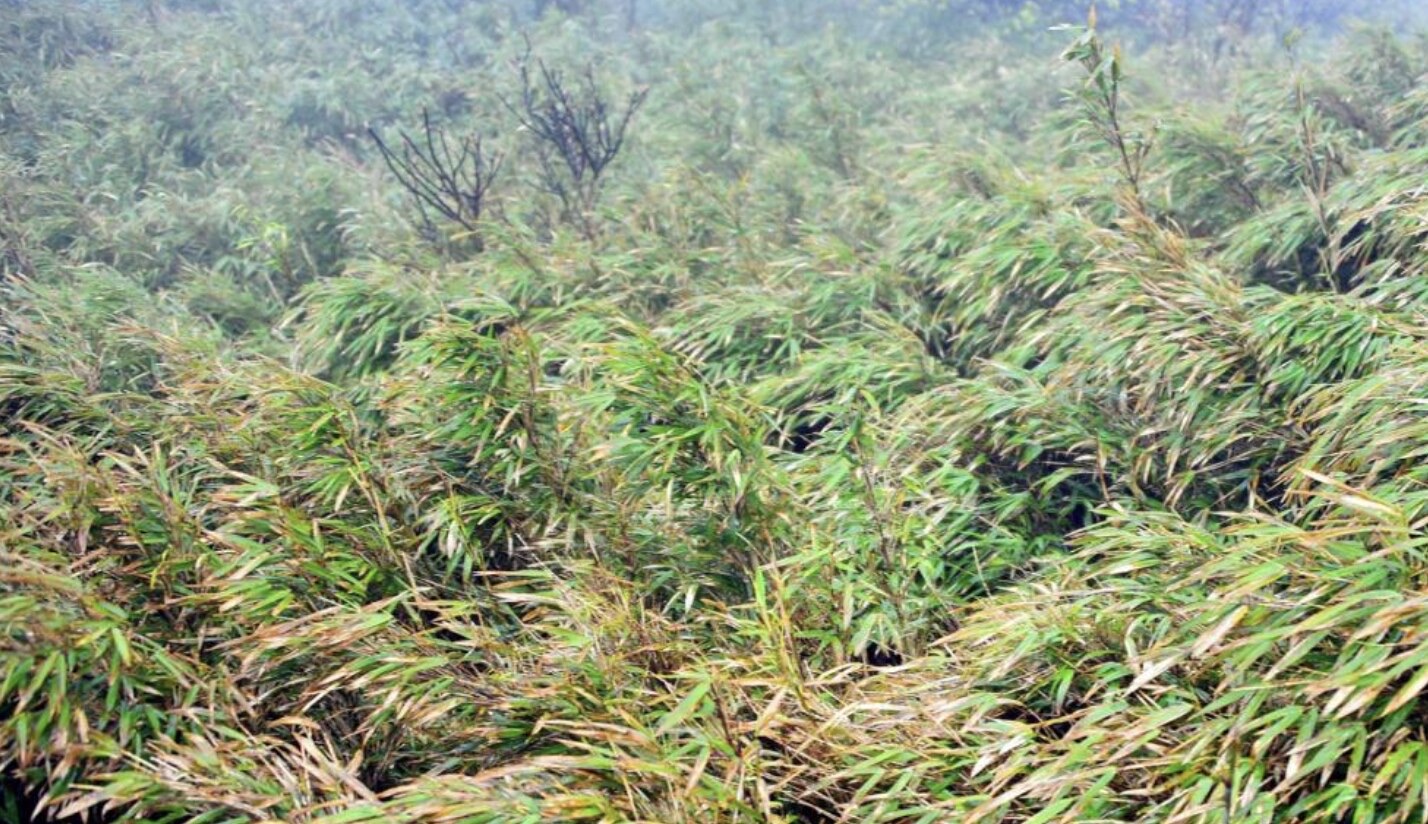
The Arrow Bamboo Forest Sea covers over 10 km² at 1,900–2,100 m on Jinfo Mountain's summit, dominated by West-China arrow bamboo (Fargesia) standing 2–4 m tall in dense, sun-dimming stands. As a core zone of the national nature reserve, it shelters rare species such as musk deer, golden pheasant and white-crowned fork-tail, and lies along the southern potential corridor of the giant panda's historical range. Wooden boardwalks thread through the groves—rustling leaves and cool breezes in summer, golden-tipped bamboo contrasting with autumn colors. Arrow bamboo flowers once every 60–120 years, after which entire stands die off and naturally regenerate, a key research subject for the mountain's ecologists. An eco-education signboard and rest pavilion mark the entrance.

On-site narration · read it where you stand

Our next stop is the Arrow Bamboo Forest Sea. Jinfo Mountain's Arrow Bamboo Forest Sea is one of the scenic area's signature natural landscapes, right next to Qianniu Ping Sky Street. The arrow bamboo here differs from ordinary bamboo: the young shoots are round in cross-section, but as the cane matures it becomes slightly square, and the nodes carry small thorny branches.

Jinfo Mountain supports 160,000 mu (roughly 107 square kilometers) of arrow bamboo forest — the largest and most concentrated arrow bamboo grove in the world. The growth pattern of arrow bamboo shoots is also unusual. The ancient agricultural text Qimin Yaoshu notes: "Most bamboo shoots emerge in the fourth month; only the Ba bamboo shoots in the eighth month, finishing by the ninth." Arrow bamboo shoots therefore break the surface in August and fully develop by September — at that point they are at their most tender and most nutritious.

Walking through the Arrow Bamboo Forest Sea, you can feel the coolness and stillness of the grove and hear the dry rustle of wind through the leaves. Among the bamboo also grow rare plants such as silver fir and dove tree, species sometimes called "living plant fossils." If you visit after September, you can try fresh arrow bamboo shoots — one of Jinfo Mountain's distinctive local foods.

Golden Turtle Facing the Sun

金龟朝阳

Golden Turtle Facing the Sun perches on the eastern cliff edge of Qianniuping at about 2,100 m and is one of Jinfo Mountain's most recognizable rock formations. Shaped from Cambrian limestone over hundreds of millions of years of weathering and dissolution, the roughly 10 m long, 5 m high boulder resembles—when viewed from the east—a giant stone turtle lifting its head toward the sun, its shell, head and limbs clearly defined. Facing open valleys to the east, it is the mountain's premier sunrise spot: dawn clouds churn, the sun crests the ridge, and golden light floods the turtle's back. A wooden viewing platform with safety rails and an interpretive sign stands here; connecting trails lead to the Cloud Walkway and cliff-hugging plank road, making it the key node of the summit's eastern route.

On-site narration · read it where you stand

We've arrived at the Golden Tortoise Facing the Sun viewing platform. This is one of Jinfo Mountain's west-slope cliff landmarks — the rock formation here closely resembles a giant tortoise stretching its neck forward, with a broad shell formed by sheer cliff walls. The tortoise's body stands roughly 300 meters tall and extends about 500 meters in length, making it one of the most recognizable features on the mountain.

On clear summer and autumn evenings, the slanting sun drenches the layered cliffs in gold, as if countless gilded Buddhas were radiating light in all directions — a spectacle of genuine power and beauty. The Golden Tortoise viewing platform is also one of the best spots for watching Jinfo Mountain's sea of clouds, particularly in the early morning when mist fills the valleys and the scene feels otherworldly.

Inside the tortoise's "mouth" there is a cave known as the Echo Cave, where legend has it you can hear the heartbeat of the mountain. For the best photographs, choose a clear day and aim for 9–10 in the morning or 4–5 in the afternoon, when the light is soft and the contours of the rock face are most clearly defined.

Cloud Walkway

云端步道

The Cloud Walkway runs along the cliff face between Qianniuping and Golden Turtle at 2,000–2,100 m, stretching about 1.5 km—the most iconic aerial route on Jinfo Mountain's eastern summit. Carved along a karst escarpment with sections of cantilevered steel, it places a rock wall on one side and a plunging valley on the other; when mist swirls in, walking it feels like treading on clouds—hence the name. Three projecting viewing platforms offer views of the Nanchuan mountain ranges and the lower-zone gorges, and are prime spots for the mountain's "Buddha's halo" and sea of clouds. The full route has safety rails and anti-slip surfacing; it may close in rain, and those with acrophobia should proceed with caution. A safety signboard and rest pavilion mark the entrance.

On-site narration · read it where you stand

We're about to step onto the Skyline Trail. The Skyline Trail runs along the edge of the cliffs on Jinfo Mountain's northwest face — a suspended walkway approximately 3.5 kilometers long, at elevations above 2,000 meters and sitting 40 to 50 meters above the ground at various points. It is one of the highest vantage points on the mountain.

Sections of the trail pitch at 85 to 89 degrees, requiring you to use both hands and feet on iron chains. Safety railings and viewing platforms are in place throughout. The Skyline Trail passes directly over karst caves including Lingguan Cave and Yanzi Cave, letting you appreciate both the open mountain scenery and the mystery of underground cave systems simultaneously.

From the Skyline Trail you can look down over Nanchuan city, with rolling peaks stretching to the horizon in every direction. On a clear day the panorama is exceptional. One side of the trail presses against moss-covered rock walls; the other opens over flowing streams far below — a combination that creates a genuinely distinctive atmosphere.

Safety reminder: Parts of the Skyline Trail are steep. Wear non-slip footwear and bring trekking poles and gloves. Hold the railings when walking and stay away from the edges. Rest points are provided along the route — if you feel tired, use them. There are also several prime photography positions along the trail, including "Jiulian Terrace," where the peaks below take on the shape of an open lotus flower.

Swallow Cave and Lingguan Cave

燕子洞和灵观洞

Swallow Cave and Lingguan Cave lie about 200 m apart on the west side of Qianniuping and form key parts of Jinfo Mountain's karst-cave system. Swallow Cave has a roughly 15 m wide, 8 m high entrance opening into a spacious chamber where thousands of rock swallows nest year-round; in spring and summer they dart in and out like dark arrows—hence the name. Inside, an underground stream and stalagmites, curtains and flowstone decorate the chamber. Lingguan Cave is named for a Daoist Lingguan statue once placed at its mouth; its interior features stalactites, columns and cave flowers, with some walls bearing natural "Buddha" silhouettes where monks and Daoist priests once practiced. Both caves are lit and equipped with boardwalks; the interior temperature holds at 12–15 °C, so an extra layer is advisable in summer. Visiting both takes about 40–60 minutes.

On-site narration · read it where you stand

We've reached Yanzi Cave and Lingguan Cave along the Skyline Trail. Both are karst cave formations on Jinfo Mountain, positioned along this section of the walkway. Yanzi Cave is home to a colony of short-billed golden swiftlets — a nationally protected rare species — that chase the clouds and mist in sweeping flights together, bringing the silent cave to life.

Yanzi Cave and Lingguan Cave formed approximately 6.5 million years ago. The interior temperature stays between 8 and 10 degrees Celsius year-round, about 10 degrees cooler than outside, so come prepared for the cold. The stalactites inside take on every imaginable form — some resembling a crane pointing the way, others like a phoenix leading to a spring — wrought over millions of years into shapes that look almost deliberate.

Important note: The cave floor is wet and slippery — wear non-slip footwear and watch your step at all times. The interior is dim; a torch or phone light is recommended. At the entrance to Yanzi Cave you'll find a four-word climbing guide inscribed on the rock wall — follow it carefully for safe passage.

Azalea Prince

杜鹃王子

,2050,(Rhododendron rex),12,40,8,,。,、、40,10。45,,10,,、,。,。

The "Azalea Prince" stands at the edge of the Arrow Bamboo Forest at about 2,050 m—an estimated 1,000-year-old wild Rhododendron rex, roughly 12 m tall, 40 cm in trunk diameter and nearly 8 m across the crown, making it the largest ancient wild rhododendron discovered on Jinfo Mountain. The mountain is a diversity center for Chinese rhododendrons, hosting over 40 species including more than 10 endemics. Each April–May the Prince bursts into bloom, its 10 cm-wide flowers ranging from pink to deep crimson, layered against a backdrop of bamboo, moss and multicolored forests—the most photographed spot of Jinfo Mountain's spring season and a key site for botanical education. A boardwalk, viewing platform and interpretive sign stand beside the tree.

On-site narration · read it where you stand

We're now heading to the Rhododendron Prince near Yaochi Ba. The Rhododendron Prince is a thousand-year-old ancient rhododendron on Jinfo Mountain, standing about 20 meters tall with a trunk diameter of 3.3 meters — it has grown on this mountain for more than a thousand years. This tree is one of Jinfo Mountain's endemic species and is associated with a romantic local legend.

The Rhododendron Prince's canopy spreads like a giant umbrella over the surrounding meadow. When the branches are in full bloom, the tree is magnificent — regal and commanding among all the flowers around it. Jinfo Mountain supports 44 species and more than 600,000 native tree rhododendrons in total, of which 7 are endemic to the mountain alone, celebrated as the "World's Six Great Rhododendron Rarities." The best viewing period runs from late April to mid-May, when the hillsides come alive with rhododendrons in red, white, and pink — layers of color stretching across the mountain.

If you have an interest in plants, take a moment to read the interpretation board beside the Rhododendron Prince to learn about its growth habits and conservation status. Its roots dig deep into karst rock fissures, its trunk twists like a dragon's body, and every late spring it reliably produces a full crown of blossoms — one of the clearest expressions of Jinfo Mountain's ecological vitality.

Yaochiba (Medicine Pool Dam)

药池坝

Yaochiba sits southwest of Qianniuping at about 2,000 m—a roughly 30,000 m² alpine meadow and wetland complex. The flat, grassy expanse is dotted with dozens of natural mineral springs and pools; Jinfo Mountain monks once drew water here to brew herbal remedies, giving the place its name ("Medicine Pool"). Surrounded by arrow bamboo and rhododendron shrub, with the Jinfo summit ridge and karst pinnacles on the horizon, the meadow turns golden in autumn against layered forests—one of the mountain's signature fall scenes. Boardwalks, rest pavilions and viewing platforms are provided, and the dam is a popular camping and stargazing spot. Westward trails lead to Ancient Buddha Cave and Jinfo Temple; southward to the Ecological Stone Forest.

On-site narration · read it where you stand

We've arrived at Yaochi Ba. Yaochi Ba is a high-altitude meadow sitting at roughly 2,100 meters elevation, broad and open, carpeted in grass. Dandelions dot the green, and small lakes and streams add to the picture.

Yaochi Ba presents a different face in every season: in summer it is lush and full of wildflowers — ideal for photography; in winter the snow covers everything and the landscape becomes still and luminous. The rhododendron groves bordering Yaochi Ba are another highlight of Jinfo Mountain, stunning in flower season when they transform the whole area in spring color.

Yaochi Ba also serves as one of Jinfo Mountain's best stargazing spots. On a clear night, the Milky Way is clearly visible overhead. If you'd like to spend the night here and experience the sky for yourself, book a campsite in advance.

Gufo Cave (Ancient Buddha Cave)

古佛洞

Gufo Cave lies west of Yaochiba at about 2,000 m and is the largest explored karst cave on Jinfo Mountain, with a total passage length of about 3 km and a developed tour route of roughly 1.2 km. Natural stone Buddha carvings at the entrance—believed to have been chiseled by monks in the Ming–Qing era from existing rock formations—gave the cave its name ("Ancient Buddha"). The interior is vast: the largest chamber rises about 30 m high and exceeds 5,000 m² in area, filled with stalagmites, stalactites, columns, curtains and cave flowers. The "Sea-Calming Pillar," a 15 m-tall, 1 m-diameter column, is the cave's signature feature. Warm-yellow lighting enhances the Buddhist atmosphere, with several stone Buddha figures and sutra inscriptions along the route. The cave holds at 11–14 °C year-round with high humidity—wear non-slip footwear. The full walk takes 50–70 minutes.

On-site narration · read it where you stand

We're now heading into Gufo Cave. Gufo Cave is the core Buddhist cultural attraction on Jinfo Mountain, positioned at 2,120 meters above sea level — one of the world's highest large-scale karst caves. It is known as both the "Number One Buddhist Cave Under Heaven" and "One Cave Containing Three Eras."

The entrance to Gufo Cave is a narrow passage 400 to 700 meters long, called the "72 Bends," a reference to the 72 hardships in Buddhist cosmology. Once through the passage, the space opens dramatically into a central chamber vast enough to hold tens of thousands of people.

The cave's most celebrated natural wonder is the Randeng Ancient Buddha — a Buddha figure formed entirely by geological processes over hundreds of millions of years, without a single mark of human craft. Randeng Buddha is the "Buddha of the Past" in Buddhist tradition, representing wisdom and enlightenment. The cave also contains 1,250 Luohan statues lining the walls in an orderly progression, every one distinct from the others, creating an overwhelming spectacle of a great assembly of the faithful.

Another defining feature of Gufo Cave is its remarkably well-preserved saltpeter smelting site. Thousands of smelting kilns survive inside, making this one of China's most important historical witnesses to early gunpowder production and the beginnings of chemical industry. The smelting operations here date back more than 700 years.

The interior temperature stays between 8 and 10 degrees Celsius year-round, about 10 degrees cooler than outside. Wear non-slip footwear inside the cave and bring a torch or phone for additional light. A digital guide system is available — scan the codes next to the Luohan statues to learn the story behind each figure.

Jinfo Summit (Jinfo Peak)

金佛顶

At about 2,238 m, Jinfo Summit is the highest point and spiritual symbol of Jinfo Mountain. The mountain takes its name from the main ridge's resemblance to a reclining Buddha when seen from a distance, and the summit occupies the "head" position. From the top, visitors can survey 360° of the Dalou range; on clear days the Guizhou Dalou main ridge and Nanchuan city are visible. Nearby stands Jinfo Temple (Fengzui Temple), the mountain's Buddhist heart—originally founded in the Song dynasty with later reconstructions, housing statues of Shakyamuni and Guanyin. The summit viewing platform with safety rails is the premier spot for sunrise, sea of clouds, "Buddha's halo" and stargazing. In winter, snow can accumulate to tens of centimeters, creating a rare southern snow-field scene. The walk from Qianniuping Sky Street takes 40–50 minutes, partly on stone steps.

On-site narration · read it where you stand

We've reached the Jinfo Peak summit. The Jinfo Peak summit is the highest point on Jinfo Mountain at 2,238 meters — the apex of the entire Dalou Mountain range. The views from here are wide open in every direction, taking in the full expanse of Jinfo Mountain as well as distant peaks and the sea of clouds.

The summit is also one of Jinfo Mountain's main wishing spots, and special events — including winter ice-and-snow festival celebrations — are held here during major holidays. Looking down from the summit, the Yaochi Ba grassland and the surrounding karst landscape stretch out in all directions, giving you a complete sense of the mountain's scale and character.

Several viewing platforms ring the summit area, including Ziyan Pavilion, which is the prime location for watching Jinfo Mountain's sea of clouds, sunrises, and the "Buddha light" phenomenon. If you want to photograph the summit at sunrise, aim to reach the platform by 5:30 in the morning — at that hour, the sea of clouds pours from the valleys like milk, and the scene is extraordinary.

Ecological Stone Forest

生态石林

Covering about 2 km² south of Yaochiba at roughly 2,000 m, the Ecological Stone Forest is a key element of Jinfo Mountain's karst landscape. Unlike the bare stone teeth of Yunnan's Shilin, Jinfo's pinnacles and stone buds are cloaked in moss, ferns, shrubs and trees—stone and forest merged into one, earning the name "living stone forest." The pinnacles, 3–8 m tall, take myriad forms—swords pointing skyward, beasts crouching among trees—interspersed with arrow bamboo, rhododendron and rare square bamboo, creating a unique "forest-on-stone" micro-ecosystem. In 2014 Jinfo Mountain was inscribed as part of the "South China Karst" Phase II World Natural Heritage, with the Ecological Stone Forest as a core heritage element. Boardwalks and interpretive signs guide visitors through a 30–40 minute walk—the best outdoor classroom for the mountain's karst geology and biodiversity.

On-site narration · read it where you stand

We're now heading to the Ecological Stone Forest. The Ecological Stone Forest is located about 1,000 meters south of Yaochi Ba and is a classic example of karst peak-forest landscape. Unlike the stone forests of Lunan in Yunnan, this one is draped in mountaintop moss-forest, where rock and tree grow together in what ecological specialists have called an "ancient ecology showcase" and "living textbook."

The rock spires and columns here take on every conceivable shape, wrapped in a covering of rare and ancient trees, vines, and ferns — a display of nature's inventiveness at its most patient. In the early morning, mist drifts through the forest, and the stone formations appear and vanish in the haze, as if the whole place belongs to another time.

The Ecological Stone Forest is old beyond reckoning and represents one of China's finest examples of high-altitude southern karst stone forest, embodying what makes Jinfo Mountain's geology unique. Photographers with telephoto lenses will find plenty of material here — the texture of the rock faces and the stone-tree relationships reward a closer look.

West Gate Cableway Lower Station

西门索道下站

The West Gate Cableway Lower Station sits at the foot of Jinfo Mountain's west slope at about 700 m—the starting point of the western passenger cableway. At roughly 2.4 km long with a 1.3 km elevation gain, the 15-minute ride is the longer and more scenically varied of Jinfo Mountain's two cableways. Cabins climb along a ridge, offering aerial views of primeval forest, stream-fed waterfalls and distant cloud seas; autumn foliage and winter rime-and-ice scenes are spectacular. The lower station has a waiting hall, ticket windows and a parking lot, plus an adjoining west-slope visitor center and dining facilities. The western route generally has fewer visitors and shorter queues than the north slope, ideal for self-drivers arriving via the western G65 expressway. An outside platform frames the western face of the main summit ridge.

On-site narration · read it where you stand

We're now riding the cable car back down from the West Gate upper station to the West Gate lower station. The West Slope cable car is approximately 2 kilometers long and takes about 10 to 15 minutes one way, returning us from over 2,000 meters at the upper station back down to the lower station in the Bitan Yougu area.

On the way down, you'll pass back through the sea of clouds and look out over Jinfo Mountain's old-growth forest, the streams, and the waterfalls of Bitan Yougu below. Hold the handrail and take in the view through the gondola windows.

The West Gate cable car lower station has a sightseeing bus stop where you can board a bus back to the West Gate visitor center. The bus ride takes about 1.5 hours and passes Jinshan Lake and Jinping Diecui along the way, so there is still scenery to enjoy on the journey out.

West Gate Visitor Center

西门游客中心

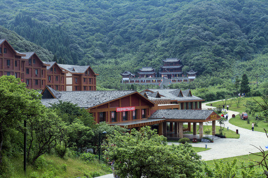
The West Gate Visitor Center stands at the foot of the west slope beside the West Gate Cableway Lower Station, serving as the main entrance and service hub for the western route. The building blends modern functionality with mountain vernacular style, housing a large ticketing hall, self-service kiosks, an information desk, luggage storage, rain-poncho rental and a first-aid point, where visitors can purchase admission, cableway and shuttle combo tickets. Outside are a large parking lot, restrooms, dining outlets and specialty shops selling square-bamboo shoots, Nanchuan rice and dried local produce. Inside, a geology-and-biodiversity exhibit uses panels and specimens to introduce Jinfo Mountain's World Natural Heritage karst geology, rare flora and fauna and rhododendron resources—an ideal "knowledge stop" before heading uphill. The walk from the center to the cableway lower station is about 3 minutes.

On-site narration · read it where you stand

We're back at the West Gate Visitor Center, and today's tour is drawing to a close. The West Gate Visitor Center is one of Jinfo Mountain's main entry points, located in Sanhui Village, Nancheng Sub-district, Nanchuan District — about 60 kilometers from central Chongqing, roughly 1.5 hours by road.

The visitor center has a ticketing counter, information desk, and rest area, providing maps, tickets, and travel advice. Admission to Jinfo Mountain is 75 yuan per person; the West Slope cable car round-trip is 80 yuan per person; the sightseeing bus round-trip is 20 yuan per person. Scenic area opening hours are 8:30 to 17:00, with ticket sales and entry closing at 15:30.

A final note: Jinfo Mountain is a large scenic area with many attractions, and we recommend choosing a route that suits your energy level and interests. If you'd like to go deeper into the mountain's history and culture, Tianxing Town is home to the Jinfo Mountain Museum, which covers the mountain's geological evolution and cultural heritage.

Thank you for spending today with us on Jinfo Mountain. We hope you're taking away good memories and great photographs. Jinfo Mountain is beautiful in every season — spring brings waves of rhododendron blossom; summer is cool and lush; autumn turns the forests to gold and red; winter wraps the peaks in snow and ice. Whenever you come back, something different will be waiting. If hiking is your thing, the Jinfo Mountain Trekking Challenge offers a "Guardian of Jinfo Mountain" medal, and collecting three medals across three events can be exchanged for a free cable car ride.

Jinfo Mountain is not only a natural wonder but a repository of history. From the Southern Song dynasty Longyan Fortress that once held off Mongol armies, to the Ming dynasty Buddhist sanctuary at Jinfo Temple; from a 700-year-old saltpeter-smelting industry to the Sanquan Hot Springs where Chiang Kai-shek and Song Meiling once stayed — the mountain carries the memory of Southwest China across the centuries.

Safe travels, and we hope to see you again.

Prefer to be shown around?

A local guide walks these 15 stops with you and answers what the page cannot.

Browse tours ↗